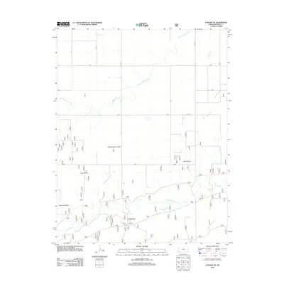
2012 Map of Elkhart NE
USGS Topo · Published 2012About this map
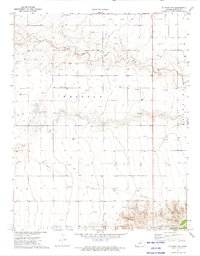
The Cimarron River and its N Fork Cimarron River dominate this stretch of southwestern Kansas, carving through a landscape defined by expansive livestock grazing lands. This survey documents a highly organized grid of rural infrastructure, where named grazing units like Pasture Number Sixteen, Yoder Pasture, and Mills Pasture indicate large-scale ranching operations. Near the river's path, the George Alwood Recreation Area provides a point of public access, while smaller water bodies such as Wilburton Pond and Mallard Ponds suggest the critical importance of water management in this arid environment. The road network, including Co RD 16 and S RD, follows the township and range lines with mathematical precision, reflecting the enduring legacy of the Public Land Survey System on the Morton County terrain.
Find a feature on this map
18 named features on this map. Tap any name to fly to it.
Don’t see what you’re looking for? This feature index may not catch every label — zoom into the map to look around manually.
Map Details
Editions of this 2012 Elkhart NE Map
This is the sole edition of this map. No revisions or reprints were ever made.
Other maps of this area

1955 · Dodge City
USGS Topo · 1:250,000

1958 · Dodge City
USGS Topo · 1:250,000

1959 · Dodge City
USGS Topo · 1:250,000

1973 · Shore Airport SW
USGS Topo · 1:24,000

1973 · Rolla NW
USGS Topo · 1:24,000

1973 · Elkhart NE
USGS Topo · 1:24,000
1973 · Elkhart North
USGS Topo · 1:24,000
1973 · Richfield SW
USGS Topo · 1:24,000
1973 · Richfield
USGS Topo · 1:24,000
1973 · Elkhart NW
USGS Topo · 1:24,000