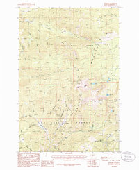
1985 Map of Elkhorn
USGS Topo · Published 1986About this map
Elkhorn and the surrounding mining district of the Elkhorn Mountains are the focal points of this mid-1980s topographical study. The map documents an area deeply marked by its extraction history, featuring numerous Mine Shafts and scattered Prospects throughout the steep terrain. This settlement, established during Montana's silver boom, is situated at the head of Elkhorn Creek, surrounded by the Helena National Forest and Deerlodge National Forest.
Find a feature on this map
53 named features on this map. Tap any name to fly to it.
Don’t see what you’re looking for? This feature index may not catch every label — zoom into the map to look around manually.
Map Details
Editions of this 1985 Elkhorn Map
2 editions found
Other maps of this area

1886 · Fort Logan
USGS Topo · 1:250,000

1889 · Helena
USGS Topo · 1:250,000

1893 · Helena
USGS Topo · 1:250,000

1899 · Boulder
USGS Topo · 1:125,000

1899 · Helena
USGS Topo · 1:250,000

1903 · Helena
USGS Topo · 1:250,000

1947 · Butte
USGS Topo · 1:250,000

1948 · White Sulphur Springs
USGS Topo · 1:250,000

1950 · Devils Fence
USGS Topo · 1:62,500

1950 · Jefferson City
USGS Topo · 1:62,500