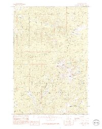
1985 Map of Elkhorn
USGS Topo · Published 1993About this map
Elkhorn sits at the heart of the southern Elkhorn Mountains in this mid-1980s record of a storied Montana mining landscape. The map reveals the intricate drainage system defined by Wilson Creek, Prickly Pear Creek, and Muskrat Creek, which carved the canyons where extraction became the primary industry. Numerous Prospects and Mine Shafts dot the terrain, particularly around the settlement and along the Slaughterhouse Creek drainage, illustrating the intensity of historical prospecting in this mineral-heavy region.
Find a feature on this map
46 named features on this map. Tap any name to fly to it.
Don’t see what you’re looking for? This feature index may not catch every label — zoom into the map to look around manually.
Map Details
Editions of this 1985 Elkhorn Map
2 editions found
Other maps of this area

1886 · Fort Logan
USGS Topo · 1:250,000

1889 · Helena
USGS Topo · 1:250,000

1893 · Helena
USGS Topo · 1:250,000

1899 · Boulder
USGS Topo · 1:125,000

1899 · Helena
USGS Topo · 1:250,000

1903 · Helena
USGS Topo · 1:250,000

1947 · Butte
USGS Topo · 1:250,000

1948 · White Sulphur Springs
USGS Topo · 1:250,000

1950 · Devils Fence
USGS Topo · 1:62,500

1950 · Jefferson City
USGS Topo · 1:62,500