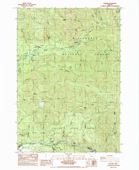
1985 Map of Elkhorn
USGS Topo · Published 1985About this map
The North Santiam River valley in the mid-1980s is a landscape defined by industrial utility and public recreation. This survey documents the canyon corridor where the Niagara Dam and the northern reaches of Big Cliff Res harness the river's flow at the Marion Co Linn Co line. Small settlements like Niagara and Minto sit along the riverbanks, serving as points of entry for the surrounding timberlands.
Find a feature on this map
45 named features on this map. Tap any name to fly to it.
Don’t see what you’re looking for? This feature index may not catch every label — zoom into the map to look around manually.
Map Details
Editions of this 1985 Elkhorn Map
This is the sole edition of this map. No revisions or reprints were ever made.
Other maps of this area

1929 · Mill City
USGS Topo · 1:125,000

1953 · Salem
USGS Topo · 1:250,000

1954 · Salem
USGS Topo · 1:250,000

1955 · Mill City
USGS Topo · 1:62,500

1956 · Quartzville
USGS Topo · 1:62,500

1956 · Battle Ax
USGS Topo · 1:62,500

1956 · Detroit
USGS Topo · 1:62,500

1960 · Salem
USGS Topo · 1:250,000

1962 · Salem
USGS Topo · 1:250,000

1963 · Salem
USGS Topo · 1:250,000