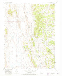
1956 Map of Elkhorn
USGS Topo · Published 1973About this map
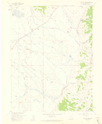
Mexican Ridge and Reinecker Ridge dominate this high-altitude landscape in Park County, where the topography transitions from the high, flat expanses of The Basin to deeply incised gulches. The settlement pattern is sparse, centered on the Elkhorn Ranch and the nearby Elkhorn Community House, connected by the winding Elkhorn Road. The reliance on local water sources is evident through numerous named springs, including Association Spring, Link Spring, and Garcia Spring, which served as critical points for ranching and travel through the arid terrain. The presence of a prominent Aqueduct cutting through the northern sections reflects the larger infrastructure efforts of the mid-20th century to manage water across the Missouri River Basin. Notable drainage systems like Sevenmile Gulch and Indian Gulch carve through the hillsides, while the ephemeral Playa Lakes provide a unique geological marker in the more level western stretches of the quadrangle.
Find a feature on this map
21 named features on this map. Tap any name to fly to it.
Don’t see what you’re looking for? This feature index may not catch every label — zoom into the map to look around manually.
Map Details
Editions of this 1956 Elkhorn Map
5 editions found
Other maps of this area

1937 · Como
USGS Topo · 1:62,500

1953 · Denver
USGS Topo · 1:250,000

1956 · Eagle Rock
USGS Topo · 1:24,000

1956 · Elkhorn
USGS Topo · 1:24,000

1956 · Sulphur Mountain
USGS Topo · 1:24,000

1956 · Garo
USGS Topo · 1:24,000

1956 · Fairplay East
USGS Topo · 1:24,000

1956 · Hartsel
USGS Topo · 1:24,000

1957 · Denver
USGS Topo · 1:250,000
1957 · Milligan Lakes
USGS Topo · 1:24,000