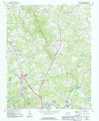
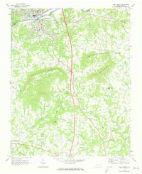
1971 Map of Elkin North
USGS Topo · Published 1994About this map
The Mitchell River flows southward through the heart of Surry County, meeting the Yadkin River near the industrial and transportation hub of Elkin. This 1971 survey, updated with 1994 revisions, illustrates the transition from the concentrated urban core of North Elkin and Elkin Valley to the surrounding agricultural uplands. The landscape is dotted with long-standing community centers such as Bennies Chapel, Mulberry Ch, and Ebenezer Ch, alongside newer infrastructure like the Elkin Municipal Airport. Transport patterns show a reliance on both traditional river crossings and modern highway developments, while local industry is represented by a Quarry and Tailings Ponds near the Yadkin. To the north, smaller settlements like Zephyr and Mountain Park anchor the rural landscape, connected by a network of creeks including Little Snow Creek and Grassy Creek.
Find a feature on this map
51 named features on this map. Tap any name to fly to it.
Don’t see what you’re looking for? This feature index may not catch every label — zoom into the map to look around manually.
Map Details
Editions of this 1971 Elkin North Map
2 editions found
Other maps of this area

1891 · Yadkinville
USGS Topo · 1:125,000

1893 · Yadkinville
USGS Topo · 1:125,000

1953 · Winston-Salem
USGS Topo · 1:250,000

1955 · Winston-Salem
USGS Topo · 1:250,000

1962 · Winston-Salem
USGS Topo · 1:250,000

1966 · Yadkinville
USGS Topo · 1:24,000

1970 · Copeland
USGS Topo · 1:24,000
1971 · Thurmond
USGS Topo · 1:24,000
1971 · Dobson
USGS Topo · 1:24,000
1971 · Elkin South
USGS Topo · 1:24,000