
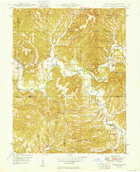
1947 Map of Elkinsville
USGS Topo · Published 1961About this map
Elkinsville serves as the focal point of this mid-century survey of south-central Indiana, situated where the Middle Fork Salt Creek and the South Fork Salt Creek converge. The landscape is defined by the densely wooded ridges and hollows of the Hoosier National Forest and Brown County State Park, showing a rural community connected by narrow roads winding through the topography.
Find a feature on this map
52 named features on this map. Tap any name to fly to it.
Don’t see what you’re looking for? This feature index may not catch every label — zoom into the map to look around manually.
Map Details
Editions of this 1947 Elkinsville Map
This is the sole edition of this map. No revisions or reprints were ever made.
Other maps of this area

1934 · Bedford
USGS Topo · 1:48,000

1937 · Bedford
USGS Topo · 1:62,500

1942 · Franklin
USGS Topo · 1:125,000

1946 · Belmont
USGS Topo · 1:24,000

1947 · Allens Creek
USGS Topo · 1:24,000

1947 · Unionville
USGS Topo · 1:24,000

1947 · Nashville
USGS Topo · 1:24,000

1949 · Nashville
USGS Topo · 1:24,000

1950 · Belmont
USGS Topo · 1:24,000
1950 · Elkinsville
USGS Topo · 1:24,000