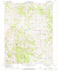
1970 Map of Elkland
USGS Topo · Published 1971About this map
Elkland sits at the junction of several county lines in the Missouri Ozarks, serving as a hub for the surrounding rural townships of Washington, Jackson, and Sheridan. This 1970 snapshot of the landscape reveals a deeply rooted community connected by a network of small churches and family burial grounds. Notable landmarks include the Elkland Sch and Union Mound Ch, alongside numerous rural chapels like Mission Chapel and Free Will Chapel.
Find a feature on this map
32 named features on this map. Tap any name to fly to it.
Don’t see what you’re looking for? This feature index may not catch every label — zoom into the map to look around manually.
Map Details
Editions of this 1970 Elkland Map
This is the sole edition of this map. No revisions or reprints were ever made.
Other maps of this area

1884 · Springfield
USGS Topo · 1:125,000

1884 · Bolivar
USGS Topo · 1:125,000

1886 · Springfield
USGS Topo · 1:125,000

1892 · Bolivar
USGS Topo · 1:125,000

1939 · Long Lane
USGS Topo · 1:62,500

1942 · Long Lane
USGS Topo · 1:62,500

1946 · Bassville
USGS Topo · 1:24,000

1946 · Niangua
USGS Topo · 1:62,500

1947 · Strafford
USGS Topo · 1:62,500

1948 · Bassville
USGS Topo · 1:24,000