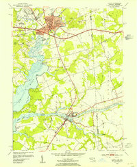
1953 Map of Elkton
USGS Topo · Published 1954About this map
The town of Elkton serves as a major regional hub in the early 1950s, where the Pennsylvania railroad and Pulaski Highway intersect at the head of the Elk River. The landscape reveals a transition from the urbanized streets of Elkton Heights and Hollingsworth Manor to the maritime and industrial corridors along the Chesapeake and Delaware Canal. Near Chesapeake City, the canal's impact is visible through a series of levees and mooring basins that facilitated heavy traffic between the Chesapeake and Delaware bays.
Find a feature on this map
60 named features on this map. Tap any name to fly to it.
Don’t see what you’re looking for? This feature index may not catch every label — zoom into the map to look around manually.
Map Details
Editions of this 1953 Elkton Map
4 editions found
Other maps of this area

1898 · Elkton
USGS Topo · 1:62,500

1899 · Dover
USGS Topo · 1:125,000

1900 · Elkton
USGS Topo · 1:62,500

1900 · Cecilton
USGS Topo · 1:62,500

1904 · Wilmington
USGS Topo · 1:62,500

1906 · Dover
USGS Topo · 1:125,000

1906 · Wilmington
USGS Topo · 1:62,500

1917 · Elkton
USGS Topo · 1:62,500

1919 · Wilmington
USGS Topo · 1:62,500

1920 · Dover
USGS Topo · 1:125,000