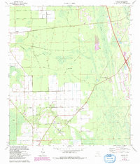
1970 Map of Elkton
USGS Topo · Published 1992About this map
Elkton and the surrounding flatwoods of St. Johns County are depicted during a period of transition, with original 1963-64 surveys updated to reflect changes through the early 1990s. The landscape is defined by the winding course of Moccasin Branch and the vast wetlands of Trestle Bay Swamp and Moultrie Swamp. Transportation is anchored by the Florida East Coast railroad, which links the settlements of Armstrong, Elkton, and Molasses Junction.
Find a feature on this map
35 named features on this map. Tap any name to fly to it.
Don’t see what you’re looking for? This feature index may not catch every label — zoom into the map to look around manually.
Map Details
Editions of this 1970 Elkton Map
3 editions found
Other maps of this area

1912 · Palatka
USGS Topo · 1:48,000

1915 · Palatka
USGS Topo · 1:62,500

1937 · Bakersville
USGS Topo · 1:24,000

1937 · Elkton
USGS Topo · 1:24,000

1937 · Crescent Beach
USGS Topo · 1:24,000

1937 · Dinner Island
USGS Topo · 1:48,000

1937 · St. Augustine
USGS Topo · 1:24,000

1943 · St. Augustine
USGS Topo · 1:62,500

1943 · Dinner Island
USGS Topo · 1:62,500

1944 · Dinner Island
USGS Topo · 1:62,500