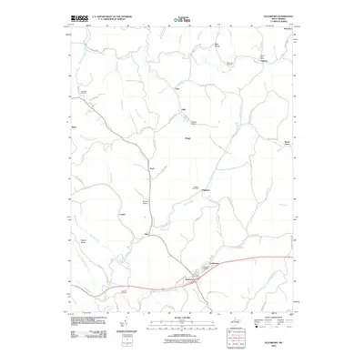
2010 Map of Ellenboro
USGS Topo · Published 2010About this map
Ellenboro serves as the focal point for this Ritchie County landscape, situated at the junction of several key local routes and home to the Ellenboro Post Office and Ellenboro Cemetery. The topography is defined by a dense network of hollows and ridges, including Pigskin Ridge and Lost Run Ridge, which separate the various forks of Bonds Creek and McKim Creek. Small settlements and rural post offices like Highland and Hebron are scattered throughout the winding valleys, often associated with family-named landmarks such as Brooks Hollow and Neely Hollow. The presence of several dedicated burial grounds, including the Fairmont Cemetery and Nine Mile Cemetery, provides a clear view of the longstanding community foundations in this part of West Virginia during the early 21st century.
Find a feature on this map
80 named features on this map. Tap any name to fly to it.
Don’t see what you’re looking for? This feature index may not catch every label — zoom into the map to look around manually.
Map Details
Editions of this 2010 Ellenboro Map
This is the sole edition of this map. No revisions or reprints were ever made.
Other maps of this area

1905 · West Union
USGS Topo · 1:62,500

1906 · Saint Marys
USGS Topo · 1:62,500

1906 · Holbrook
USGS Topo · 1:62,500

1907 · Harrisville
USGS Topo · 1:62,500

1924 · St Marys
USGS Topo · 1:62,500

1924 · Harrisville
USGS Topo · 1:62,500

1924 · West Union
USGS Topo · 1:62,500

1924 · Holbrook
USGS Topo · 1:62,500

1926 · Harrisville
USGS Topo · 1:62,500

1926 · Holbrook
USGS Topo · 1:62,500