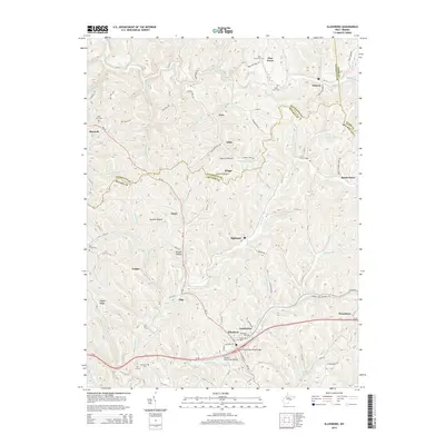
2014 Map of Ellenboro
USGS Topo · Published 2014About this map
Bonds Creek and its many tributaries, including Whiskey Run and Hushers Run, carve a dense network of ridges and hollows across this part of Ritchie County and Pleasants County. The town of Ellenboro serves as a central junction, where WV-16 meets the primary east-west corridor of Us-50. This era shows the repurposing of old industrial infrastructure, most notably the N Bend State Park Rail Trl which follows the former rail grade through Pennsboro and Lamberton.
Find a feature on this map
96 named features on this map. Tap any name to fly to it.
Don’t see what you’re looking for? This feature index may not catch every label — zoom into the map to look around manually.
Map Details
Editions of this 2014 Ellenboro Map
This is the sole edition of this map. No revisions or reprints were ever made.
Other maps of this area

1905 · West Union
USGS Topo · 1:62,500

1906 · Saint Marys
USGS Topo · 1:62,500

1906 · Holbrook
USGS Topo · 1:62,500

1907 · Harrisville
USGS Topo · 1:62,500

1924 · St Marys
USGS Topo · 1:62,500

1924 · Harrisville
USGS Topo · 1:62,500

1924 · West Union
USGS Topo · 1:62,500

1924 · Holbrook
USGS Topo · 1:62,500

1926 · Harrisville
USGS Topo · 1:62,500

1926 · Holbrook
USGS Topo · 1:62,500