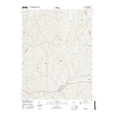
2016 Map of Ellenboro
USGS Topo · Published 2016About this map
Ellenboro serves as a central hub in this western Ritchie County landscape, where the Larry Hacker Memorial Bridge spans the modern infrastructure that parallels the older path of Old US Hwy 50. The terrain is defined by a dense network of runs and hollows, such as Church Hollow and Brooks Hollow, which dictate the winding paths of rural routes like Co Rte 30. Small settlements and named locales including Highland, Finch, and Pike are scattered across the ridges and valley floors, often centered around watercourses like Bonds Creek and McKim Creek. The map provides significant detail for local historians, documenting several burial sites such as Nine Mile Cem near Maxwell and Fairmont Cem further south. These landmarks, along with features like Pigskin Ridge, illustrate the persistent settlement patterns of this Appalachian region.
Find a feature on this map
105 named features on this map. Tap any name to fly to it.
Don’t see what you’re looking for? This feature index may not catch every label — zoom into the map to look around manually.
Map Details
Editions of this 2016 Ellenboro Map
This is the sole edition of this map. No revisions or reprints were ever made.
Other maps of this area

1905 · West Union
USGS Topo · 1:62,500

1906 · Saint Marys
USGS Topo · 1:62,500

1906 · Holbrook
USGS Topo · 1:62,500

1907 · Harrisville
USGS Topo · 1:62,500

1924 · St Marys
USGS Topo · 1:62,500

1924 · Harrisville
USGS Topo · 1:62,500

1924 · West Union
USGS Topo · 1:62,500

1924 · Holbrook
USGS Topo · 1:62,500

1926 · Harrisville
USGS Topo · 1:62,500

1926 · Holbrook
USGS Topo · 1:62,500