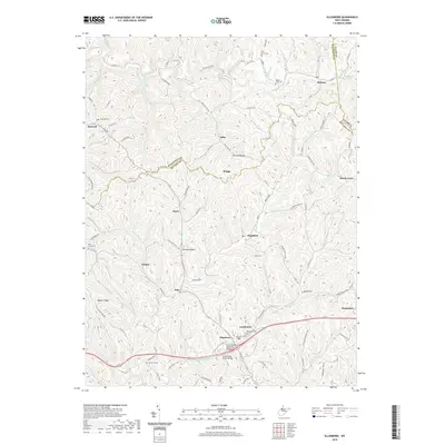
2019 Map of Ellenboro
USGS Topo · Published 2019About this map
Ellenboro and Pennsboro anchor the southern corridor of this Ritchie County landscape, where the N Bend Rail-Trail follows the path of former rail lines through the valley. The terrain is defined by a dense network of ridges and hollows, such as Seckman Ridge and Brooks Hollow, with small settlements like Highland and Pike situated along the winding secondary roads. Genealogists will find several burial sites preserved across the hills, including Pine Grove Cem and Nine Mile Cem near Maxwell. Modern engineering is noted through the Larry Hacker Memorial Bridge and the Hushers Run Girder Bridge, which cross the drainage of Hushers Run. The map also captures the transition between county lines, marking the borders with Pleasants and Tyler counties to the north.
Find a feature on this map
106 named features on this map. Tap any name to fly to it.
Don’t see what you’re looking for? This feature index may not catch every label — zoom into the map to look around manually.
Map Details
Editions of this 2019 Ellenboro Map
This is the sole edition of this map. No revisions or reprints were ever made.
Other maps of this area

1905 · West Union
USGS Topo · 1:62,500

1906 · Saint Marys
USGS Topo · 1:62,500

1906 · Holbrook
USGS Topo · 1:62,500

1907 · Harrisville
USGS Topo · 1:62,500

1924 · St Marys
USGS Topo · 1:62,500

1924 · Harrisville
USGS Topo · 1:62,500

1924 · West Union
USGS Topo · 1:62,500

1924 · Holbrook
USGS Topo · 1:62,500

1926 · Harrisville
USGS Topo · 1:62,500

1926 · Holbrook
USGS Topo · 1:62,500