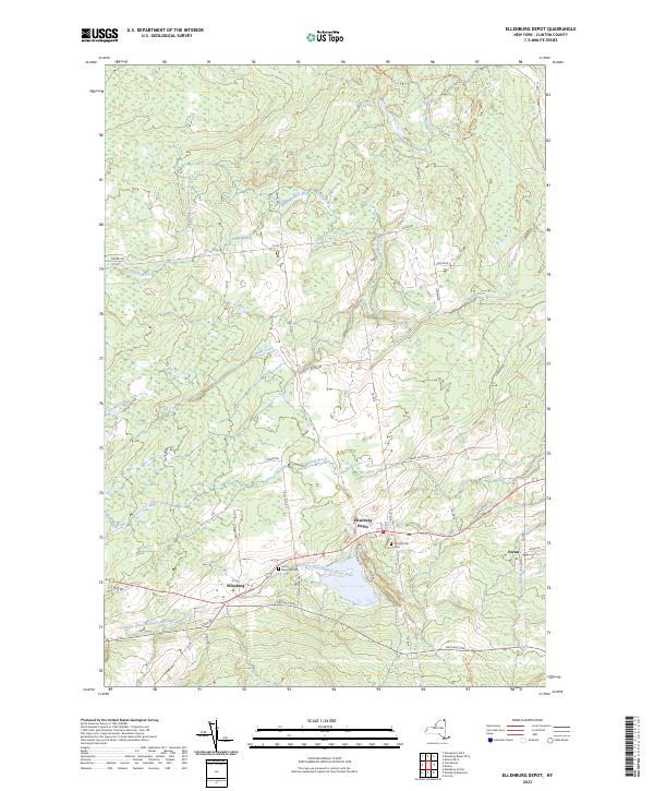
2023 Map of Ellenburg Depot
USGS Topo · Published 2023About this map
Ellenburg Depot and nearby Ellenburg serve as the primary hubs in this Clinton County landscape, where the North Branch Great Chazy River flows through the southern valley. The geography is defined by a dense network of secondary roads and trails, such as Military Tpke and Old State Rd, which connect the small settlements to the surrounding timber and agricultural lands. Genealogical interest is centered on several burial grounds, including Saint Edmunds Cem and Sheldon Hill Cem, situated near the residential clusters.
Find a feature on this map
41 named features on this map. Tap any name to fly to it.
Don’t see what you’re looking for? This feature index may not catch every label — zoom into the map to look around manually.
Map Details
Editions of this 2023 Ellenburg Depot Map
This is the sole edition of this map. No revisions or reprints were ever made.
Other maps of this area

1895 · Mooers
USGS Topo · 1:62,500

1899 · Mooers
USGS Topo · 1:62,500

1915 · Churubusco
USGS Topo · 1:62,500

1942 · Mooers
USGS Topo · 1:62,500

1943 · Churubusco
USGS Topo · 1:62,500

1943 · Mooers
USGS Topo · 1:62,500

1950 · Lake Champlain
USGS Topo · 1:250,000
1956 · Mooers
USGS Topo · 1:62,500

1958 · Lake Champlain
USGS Topo · 1:250,000

1962 · Lake Champlain
USGS Topo · 1:250,000