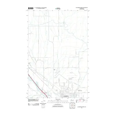
2011 Map of Ellensburg North
USGS Topo · Published 2011About this map
The northern edge of Ellensburg serves as the focal point for this survey of the Kittitas Valley, where the urban grid meets the agricultural reaches of central Washington. The northern portion of the Central Washington University campus is clearly visible, marking the transition from the city center to the surrounding countryside. This landscape is defined by its complex irrigation and drainage network, with several major waterways including Reecer Creek, Currier Creek, and Wilson Creek flowing southward toward the Yakima River. These natural and man-made water systems reflect the region's long-standing reliance on water management for its fertile agricultural lands.
Find a feature on this map
84 named features on this map. Tap any name to fly to it.
Don’t see what you’re looking for? This feature index may not catch every label — zoom into the map to look around manually.
Map Details
Editions of this 2011 Ellensburg North Map
This is the sole edition of this map. No revisions or reprints were ever made.
Other maps of this area

1897 · Mount Stuart
USGS Topo · 1:125,000

1899 · Ellensburg
USGS Topo · 1:125,000

1901 · Ellensburg
USGS Topo · 1:125,000

1902 · Mount Stuart
USGS Topo · 1:125,000

1920 · Colockum Pass
USGS Topo · 1:125,000

1922 · Colockum Pass
USGS Topo · 1:125,000

1938 · Badger Pocket
USGS Topo · 1:48,000

1943 · Badger Pocket
USGS Topo · 1:62,500

1950 · Yakima
USGS Topo · 1:250,000

1953 · Kittitas
USGS Topo · 1:24,000