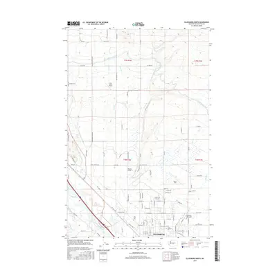
2017 Map of Ellensburg North
USGS Topo · Published 2017About this map
Ellensburg anchors the southern edge of this map, showcasing the urban transition into the fertile Kittitas Valley. The city's northern reaches are dominated by the Central Washington University campus and a dense grid of residential streets. Just beyond the city limits, a complex network of irrigation infrastructure including the North Branch Canal, Ellensburg Water Canal, and W Side Canal illustrates the intensive water management required for regional agriculture. To the north, the landscape opens into canyons and creeks, with Reecer Creek and Currier Creek flowing south toward the Yakima River. This 2017 study captures the modern footprints of local landmarks like Bowers Field and the Independent Order of Odd Fellows Cemetery, while rural roads such as Hungry Junction Road and Brick Mill Road maintain the historical transport patterns of the surrounding farmland.
Find a feature on this map
94 named features on this map. Tap any name to fly to it.
Don’t see what you’re looking for? This feature index may not catch every label — zoom into the map to look around manually.
Map Details
Editions of this 2017 Ellensburg North Map
This is the sole edition of this map. No revisions or reprints were ever made.
Other maps of this area

1897 · Mount Stuart
USGS Topo · 1:125,000

1899 · Ellensburg
USGS Topo · 1:125,000

1901 · Ellensburg
USGS Topo · 1:125,000

1902 · Mount Stuart
USGS Topo · 1:125,000

1920 · Colockum Pass
USGS Topo · 1:125,000

1922 · Colockum Pass
USGS Topo · 1:125,000

1938 · Badger Pocket
USGS Topo · 1:48,000

1943 · Badger Pocket
USGS Topo · 1:62,500

1950 · Yakima
USGS Topo · 1:250,000

1953 · Kittitas
USGS Topo · 1:24,000