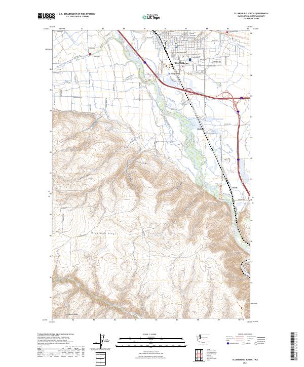
2023 Map of Ellensburg South
USGS Topo · Published 2023About this map
The southern outskirts of Ellensburg and the agricultural expanse of the Kittitas Valley are defined here by a sophisticated network of early irrigation and mountain drainage. The Yakima River bisects the landscape, flanked by vital water management features such as the West Side Canal, Clinesmith Irrigation Ditch, and Bull Ditch. These waterways transformed the arid flats between the rising slopes of Manastash Ridge and the northern valley floor into productive farmland.
Find a feature on this map
85 named features on this map. Tap any name to fly to it.
Don’t see what you’re looking for? This feature index may not catch every label — zoom into the map to look around manually.
Map Details
Editions of this 2023 Ellensburg South Map
This is the sole edition of this map. No revisions or reprints were ever made.
Other maps of this area

1897 · Mount Stuart
USGS Topo · 1:125,000

1899 · Ellensburg
USGS Topo · 1:125,000

1901 · Ellensburg
USGS Topo · 1:125,000

1902 · Mount Stuart
USGS Topo · 1:125,000

1920 · Colockum Pass
USGS Topo · 1:125,000

1922 · Colockum Pass
USGS Topo · 1:125,000

1938 · Badger Pocket
USGS Topo · 1:48,000

1943 · Badger Pocket
USGS Topo · 1:62,500

1950 · Yakima
USGS Topo · 1:250,000

1953 · Kittitas
USGS Topo · 1:24,000