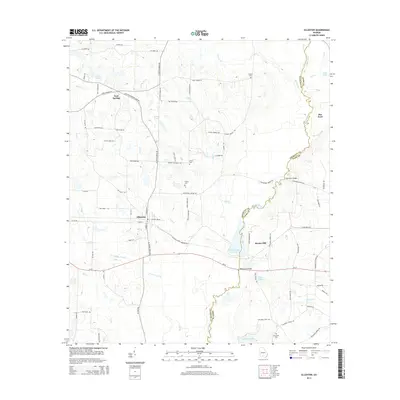
2014 Map of Ellenton
USGS Topo · Published 2014About this map
The town of Ellenton serves as the primary hub in this South Georgia landscape, situated at the intersection of several key routes including Ellenton Omega Rd and Ellenton-Norman Park Rd. The area is defined by the winding course of the Little River, which forms the meandering boundary between Colquitt and Cook Counties. Along its banks, features like Flat Ford and the expansive Reed Bingham Park Lake illustrate the historical importance of the river system to local transport and recreation. To the north, the settlement of Cool Springs anchors a rural district characterized by small family-named water bodies like Vickers Lake and Grist Lake. Genealogists will find significant value in the scattered burial grounds that dot the countryside, including Vickers Cem, Baker Cem, and Sylvester Cem, many of which are tucked away along namesake roads like Billy Vickers Rd and John Vickers Rd.
Find a feature on this map
83 named features on this map. Tap any name to fly to it.
Don’t see what you’re looking for? This feature index may not catch every label — zoom into the map to look around manually.
Map Details
Editions of this 2014 Ellenton Map
This is the sole edition of this map. No revisions or reprints were ever made.
Other maps of this area

1953 · Waycross
USGS Topo · 1:250,000

1958 · Waycross
USGS Topo · 1:250,000

1973 · Norman Park
USGS Topo · 1:24,000

1973 · Adel
USGS Topo · 1:24,000

1973 · Cecil
USGS Topo · 1:24,000

1973 · Lenox
USGS Topo · 1:24,000

1973 · Omega
USGS Topo · 1:24,000

1974 · Berlin East
USGS Topo · 1:24,000

1974 · Pineboro
USGS Topo · 1:24,000
1974 · Ellenton
USGS Topo · 1:24,000