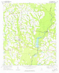
1974 Map of Ellenton
USGS Topo · Published 1977About this map
Ellenton serves as the primary hub of this South Georgia landscape, situated at the junction of the Georgia Northern railroad and several regional roads. The topography is defined by the winding course of the Little River, which forms the boundary between Colquitt and Cook counties. A significant portion of the eastern map is dedicated to Reed Bingham State Park, featuring a large reservoir with multiple boat ramps, a Campground, and a Picnic Area.
Find a feature on this map
32 named features on this map. Tap any name to fly to it.
Don’t see what you’re looking for? This feature index may not catch every label — zoom into the map to look around manually.
Map Details
Editions of this 1974 Ellenton Map
This is the sole edition of this map. No revisions or reprints were ever made.
Other maps of this area

1953 · Waycross
USGS Topo · 1:250,000

1958 · Waycross
USGS Topo · 1:250,000

1973 · Norman Park
USGS Topo · 1:24,000

1973 · Adel
USGS Topo · 1:24,000

1973 · Cecil
USGS Topo · 1:24,000

1973 · Lenox
USGS Topo · 1:24,000

1973 · Omega
USGS Topo · 1:24,000

1974 · Berlin East
USGS Topo · 1:24,000

1974 · Pineboro
USGS Topo · 1:24,000
1978 · Berlin West
USGS Topo · 1:24,000