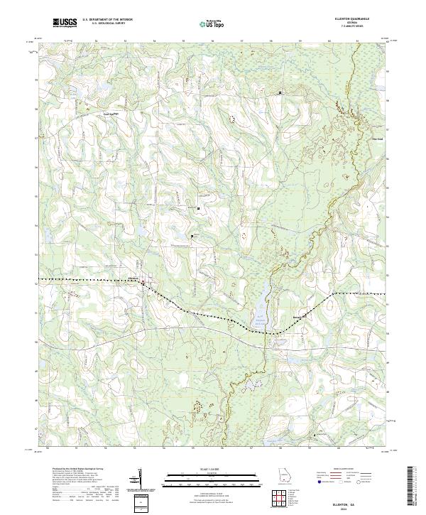
2024 Map of Ellenton
USGS Topo · Published 2024About this map
The town of Ellenton serves as the central hub of this South Georgia landscape, where the meandering course of the Little River defines the border between Colquitt and Cook counties. The terrain is characterized by a dense network of blackwater creeks and drainage basins, including Warrior Creek, Buck Creek, and Bull Creek, which feed into local landmarks like Reed Bingham Park Lake. Small rural communities such as Cool Springs remain tied to a grid of county roads that bear the names of longstanding local families, such as John Vickers Rd and Lester Norman Rd. For genealogists, the presence of family-linked burial sites like Vickers Cem, Baker Cem, and Folsom Cem provides critical points for tracing ancestral connections. The map also highlights the agricultural and transport history of the region through features like the Flat Ford and the path of Lonestar School Rd, reflecting a landscape deeply shaped by its river systems and early settlement patterns.
Find a feature on this map
87 named features on this map. Tap any name to fly to it.
Don’t see what you’re looking for? This feature index may not catch every label — zoom into the map to look around manually.
Map Details
Editions of this 2024 Ellenton Map
This is the sole edition of this map. No revisions or reprints were ever made.
Other maps of this area

1953 · Waycross
USGS Topo · 1:250,000

1958 · Waycross
USGS Topo · 1:250,000

1973 · Norman Park
USGS Topo · 1:24,000

1973 · Adel
USGS Topo · 1:24,000

1973 · Cecil
USGS Topo · 1:24,000

1973 · Lenox
USGS Topo · 1:24,000

1973 · Omega
USGS Topo · 1:24,000

1974 · Berlin East
USGS Topo · 1:24,000

1974 · Pineboro
USGS Topo · 1:24,000
1974 · Ellenton
USGS Topo · 1:24,000