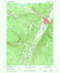
1969 Map of Ellenville
USGS Topo · Published 1971About this map
The village of Ellenville serves as the focal point of this late-1960s survey, situated where Sandburg Creek meets the Rondout Creek. The settlement pattern reflects a valley community organized around civic and industrial infrastructure, including a Municipal Building, Community Hospital, and the Ellenville Central School. To the west, the landscape transitions into the town of Wawarsing and the Greenfield Park area, where smaller water bodies like Windsor Lake and Cranberry Lake dot the higher elevations.
Find a feature on this map
80 named features on this map. Tap any name to fly to it.
Don’t see what you’re looking for? This feature index may not catch every label — zoom into the map to look around manually.
Map Details
Editions of this 1969 Ellenville Map
3 editions found
Other maps of this area

1903 · Slide Mountain
USGS Topo · 1:62,500

1904 · Ellenville
USGS Topo · 1:62,500

1905 · Slide Mountain
USGS Topo · 1:62,500

1906 · Ellenville
USGS Topo · 1:62,500

1909 · Monticello
USGS Topo · 1:62,500

1910 · Neversink
USGS Topo · 1:62,500

1911 · Monticello
USGS Topo · 1:62,500

1942 · Neversink
USGS Topo · 1:62,500

1942 · Lackawack
USGS Topo · 1:24,000

1942 · Kerhonkson
USGS Topo · 1:24,000