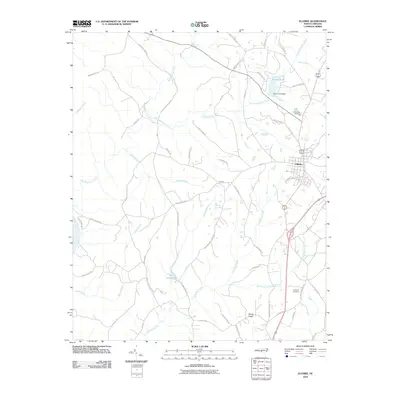
2010 Map of Ellerbe
USGS Topo · Published 2010About this map
Ellerbe serves as the primary hub of this North Carolina landscape, where the residential street grid gives way to an intricate network of rural roads and watercourses. The local hydrology is defined by the winding paths of Big Mountain Creek and Cartledge Creek, which drain the surrounding terrain near smaller communities like Lentzton and Sandy Ridge. To the north, Rankin Pond Dam and Rankin Pond suggest localized water management, while Camp Dick Henning represents a distinct recreational or institutional landmark in the area.
Find a feature on this map
56 named features on this map. Tap any name to fly to it.
Don’t see what you’re looking for? This feature index may not catch every label — zoom into the map to look around manually.
Map Details
Editions of this 2010 Ellerbe Map
This is the sole edition of this map. No revisions or reprints were ever made.
Other maps of this area

1942 · Troy
USGS Topo · 1:125,000

1942 · Rockingham
USGS Topo · 1:125,000

1949 · Millstone Lake
USGS Topo · 1:24,000

1949 · Hamlet
USGS Topo · 1:24,000

1949 · Hamlet
USGS Topo · 1:62,500

1949 · Jackson Springs
USGS Topo · 1:62,500

1950 · Norman
USGS Topo · 1:24,000

1953 · Florence
USGS Topo · 1:250,000

1953 · Raleigh
USGS Topo · 1:250,000

1954 · Florence
USGS Topo · 1:250,000