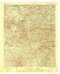
1911 Map of Ellijay
USGS Topo · Published 1926About this map
Ellijay and East Ellijay serve as the focal point of this North Georgia mountain landscape, situated at the confluence of the Ellijay River and the Cartecay River to form the Coosawattee River. The terrain is characterized by a dense network of ridges and gaps, including Hickorynut Gap and Stanley Gap, which dictated early settlement patterns and the winding routes of the Louisville and Nashville RR and the Marietta and North Georgia RR.
Find a feature on this map
155 named features on this map. Tap any name to fly to it.
Don’t see what you’re looking for? This feature index may not catch every label — zoom into the map to look around manually.
Map Details
Editions of this 1911 Ellijay Map
4 editions found

Other maps of this area

1886 · Dalton
USGS Topo · 1:125,000

1886 · Cleveland
USGS Topo · 1:125,000

1886 · Dahlonega
USGS Topo · 1:125,000

1888 · Ellijay
USGS Topo · 1:125,000

1890 · Suwanee
USGS Topo · 1:125,000

1890 · Cartersville
USGS Topo · 1:125,000

1891 · Gainesville
USGS Topo · 1:125,000

1891 · Cartersville
USGS Topo · 1:125,000

1892 · Dahlonega
USGS Topo · 1:125,000

1892 · Cleveland
USGS Topo · 1:125,000