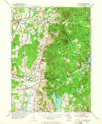
1953 Map of Ellington
USGS Topo · Published 1965About this map
Shenipsit State Forest dominates the eastern half of this Connecticut landscape, where the wooded heights of Soapstone Mtn and Bald Mtn contrast with the agricultural valley to the west. The mid-century topography reveals a patchwork of rural holdings and small settlements connected by a dense network of country lanes like Egypt Road and Ninth District Road. Along the Scantic River, Somersville and its Mill Pond represent the region's industrial heritage, while the southern reaches near Windemere show the early stages of suburban expansion from the neighboring manufacturing centers.
Find a feature on this map
81 named features on this map. Tap any name to fly to it.
Don’t see what you’re looking for? This feature index may not catch every label — zoom into the map to look around manually.
Map Details
Editions of this 1953 Ellington Map
3 editions found
Other maps of this area

1886 · Springfield
USGS Topo · 1:62,500

1887 · Palmer
USGS Topo · 1:62,500

1889 · Springfield
USGS Topo · 1:62,500

1889 · Palmer
USGS Topo · 1:62,500

1892 · Hartford
USGS Topo · 1:62,500

1892 · Tolland
USGS Topo · 1:62,500

1893 · Springfield
USGS Topo · 1:62,500

1893 · Palmer
USGS Topo · 1:62,500

1895 · Springfield
USGS Topo · 1:62,500

1896 · Holyoke
USGS Topo · 1:125,000