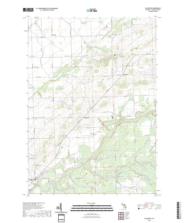
2023 Map of Ellington
USGS Topo · Published 2023About this map
Ellington and the surrounding township are defined by a complex network of agricultural drainage systems and the winding course of the Cass River. This landscape reflects a long history of land management, where named watercourses like Humes Branch, Hiser Drain, and Lockwood Drain have supported the region's farming heritage. For genealogists and local researchers, the presence of the Tuscola County Poor Farm Cem near the southern edge of the survey provides a poignant connection to the area's social history.
Find a feature on this map
103 named features on this map. Tap any name to fly to it.
Don’t see what you’re looking for? This feature index may not catch every label — zoom into the map to look around manually.
Map Details
Editions of this 2023 Ellington Map
This is the sole edition of this map. No revisions or reprints were ever made.
Other maps of this area

1954 · Flint
USGS Topo · 1:250,000

1958 · Flint
USGS Topo · 1:250,000

1963 · East Dayton
USGS Topo · 1:24,000

1963 · Kingston
USGS Topo · 1:24,000

1963 · Cass City
USGS Topo · 1:24,000

1963 · Ellington
USGS Topo · 1:24,000

1963 · Gagetown
USGS Topo · 1:24,000

1963 · Caro
USGS Topo · 1:24,000

1963 · Owendale
USGS Topo · 1:24,000

1963 · Colling
USGS Topo · 1:24,000