
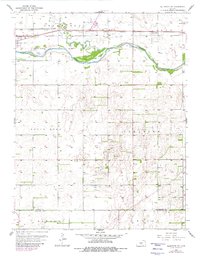
1957 Map of Ellinwood SW
USGS Topo · Published 1958About this map
The Arkansas River winds through the northern portion of this landscape, flanked by a network of levee structures and the Atchison Topeka and Santa Fe railroad line. The terrain transitions from the Walnut Creek bottoms near Great Bend into the undulating sand hills of the Great Bend Prairie. This 1957 survey captures the intensive oil development of the era, with dozens of Oil Wells peppered across the southern townships of South Bend and Comanche.
Find a feature on this map
21 named features on this map. Tap any name to fly to it.
Don’t see what you’re looking for? This feature index may not catch every label — zoom into the map to look around manually.
Map Details
Editions of this 1957 Ellinwood SW Map
2 editions found
Other maps of this area

1891 · Great Bend
USGS Topo · 1:125,000

1893 · Great Bend
USGS Topo · 1:125,000

1955 · Great Bend
USGS Topo · 1:250,000

1956 · Ellinwood NE
USGS Topo · 1:24,000

1956 · Ellinwood NW
USGS Topo · 1:24,000

1957 · Great Bend
USGS Topo · 1:250,000

1957 · Ellinwood
USGS Topo · 1:24,000

1958 · Great Bend
USGS Topo · 1:250,000

1958 · Great Bend
USGS Topo · 1:24,000

1959 · Great Bend NE
USGS Topo · 1:24,000