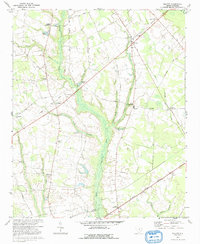
1973 Map of Elliott
USGS Topo · Published 1991About this map
Black River meanders through the heart of this landscape, its wide floodplain defining the border between Lee and Sumter counties. The agricultural character of the region in the early 1970s is evident in the numerous small settlements and family-named water features like Mattie Js Pond and Player Pond. Transport patterns show a transition from the older rail era to modern roadway reliance, with an Old Railroad Grade and Railroad Grade appearing alongside the active Seaboard Coast Line and Railroad corridors.
Find a feature on this map
43 named features on this map. Tap any name to fly to it.
Don’t see what you’re looking for? This feature index may not catch every label — zoom into the map to look around manually.
Map Details
Editions of this 1973 Elliott Map
2 editions found
Other maps of this area

1920 · Mayesville
USGS Topo · 1:48,000

1921 · Mayesville
USGS Topo · 1:62,500

1941 · Spartanburg
USGS Topo · 1:250,000

1943 · Mayesville
USGS Topo · 1:62,500

1946 · Sumter
USGS Topo · 1:62,500

1953 · Spartanburg
USGS Topo · 1:250,000

1954 · Augusta
USGS Topo · 1:250,000

1957 · Sumter East
USGS Topo · 1:24,000

1957 · Ashwood
USGS Topo · 1:62,500

1957 · Sumter
USGS Topo · 1:62,500