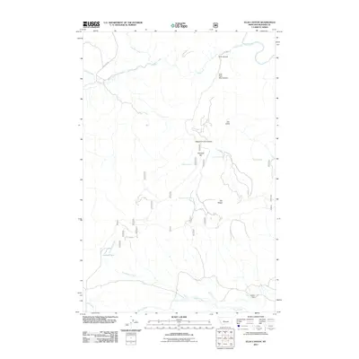
2011 Map of Ellis Canyon
USGS Topo · Published 2011About this map
Ellis Canyon and the Dry Range dominate this interior Montana landscape, where drainage systems from the Big Belt Mountains carve through high-elevation terrain. Water management is a central theme of the region, evidenced by landmarks such as Dabler Dam, Ashford Tank, and numerous named water sources like Weaning Corral Spring and Den Gulch Spring. The geography is defined by the convergence of several major drainages, including Rock Creek, Beaver Creek, and the Smith River in the northeastern corner. Ranching and land management footprints are visible in names like Haystack Bar and the road network of Lingshire Rd. This survey highlights the complex hydrography of Meagher County, tracing the forks of East Fork Ellis Canyon and West Fork Ellis Canyon as they move through a landscape shaped by both natural erosion and livestock infrastructure.
Find a feature on this map
20 named features on this map. Tap any name to fly to it.
Don’t see what you’re looking for? This feature index may not catch every label — zoom into the map to look around manually.
Map Details
Editions of this 2011 Ellis Canyon Map
This is the sole edition of this map. No revisions or reprints were ever made.
Other maps of this area

1886 · Fort Logan
USGS Topo · 1:250,000

1948 · White Sulphur Springs
USGS Topo · 1:250,000

1958 · White Sulphur Springs
USGS Topo · 1:250,000

1961 · White Sulphur Springs
USGS Topo · 1:250,000

1965 · White Sulphur Springs
USGS Topo · 1:250,000

1966 · Lingshire
USGS Topo · 1:24,000

1966 · Whites City
USGS Topo · 1:24,000

1966 · Watson
USGS Topo · 1:24,000

1966 · Lingshire NE
USGS Topo · 1:24,000
1966 · Ellis Canyon
USGS Topo · 1:24,000