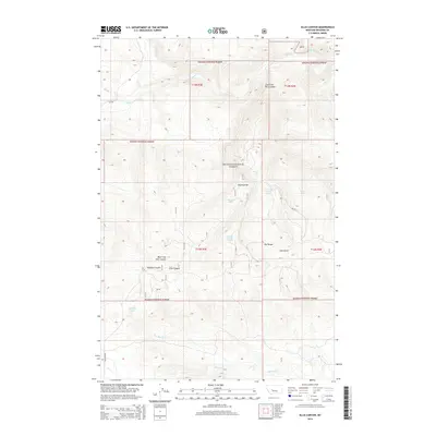
2014 Map of Ellis Canyon
USGS Topo · Published 2014About this map
Helena National Forest lands dominate this central Montana landscape, where the Smith River cuts across the northern edge of the terrain. The map captures a rugged topography defined by the Dry Range and a complex network of drainages including Ellis Canyon and its western branch, West Fork Ellis Canyon. Water resources are a critical element of this high-country environment, evidenced by named sites such as Haystack Spring, Weaning Corral Spring, and the man-made Ashford Tank.
Find a feature on this map
42 named features on this map. Tap any name to fly to it.
Don’t see what you’re looking for? This feature index may not catch every label — zoom into the map to look around manually.
Map Details
Editions of this 2014 Ellis Canyon Map
This is the sole edition of this map. No revisions or reprints were ever made.
Other maps of this area
1886 · Fort Logan
USGS Topo · 1:250,000
1948 · White Sulphur Springs
USGS Topo · 1:250,000
1958 · White Sulphur Springs
USGS Topo · 1:250,000
1961 · White Sulphur Springs
USGS Topo · 1:250,000
1965 · White Sulphur Springs
USGS Topo · 1:250,000
1966 · Lingshire
USGS Topo · 1:24,000
1966 · Whites City
USGS Topo · 1:24,000
1966 · Watson
USGS Topo · 1:24,000
1966 · Lingshire NE
USGS Topo · 1:24,000
1966 · Ellis Canyon
USGS Topo · 1:24,000