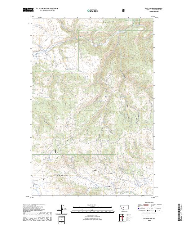
2024 Map of Ellis Canyon
USGS Topo · Published 2024About this map
The Helena National Forest dominates this section of the Dry Range, where the steep drainages of Ellis Canyon and its forks feed the northward-flowing Smith River. This 2024 map details a landscape managed for resource protection and grazing, evidenced by the distribution of water sources like Winning Corral Spring, Den Gulch Spring, and Weston Spring. Human infrastructure is sparse, characterized primarily by ranching and forest management features such as Ashford Tank and the network of forest access routes. The presence of Haystack Bar and the transition from the high canyons to the Beaver Creek valley illustrates the complex topography of Meagher County's mountain-and-basin country. These modern surveys provide critical context for understanding how the public lands of Montana remain tied to the essential locations of springs and creeks like Freeman Creek and Rock Creek.
Find a feature on this map
26 named features on this map. Tap any name to fly to it.
Don’t see what you’re looking for? This feature index may not catch every label — zoom into the map to look around manually.
Map Details
Editions of this 2024 Ellis Canyon Map
This is the sole edition of this map. No revisions or reprints were ever made.
Other maps of this area

1886 · Fort Logan
USGS Topo · 1:250,000

1948 · White Sulphur Springs
USGS Topo · 1:250,000

1958 · White Sulphur Springs
USGS Topo · 1:250,000

1961 · White Sulphur Springs
USGS Topo · 1:250,000

1965 · White Sulphur Springs
USGS Topo · 1:250,000

1966 · Lingshire
USGS Topo · 1:24,000

1966 · Whites City
USGS Topo · 1:24,000

1966 · Watson
USGS Topo · 1:24,000

1966 · Lingshire NE
USGS Topo · 1:24,000
1966 · Ellis Canyon
USGS Topo · 1:24,000