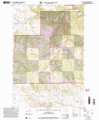
2001 Map of Ellis Canyon
USGS Topo · Published 2004About this map
The Smith River winds through the northern portion of this Meagher County landscape, cutting a deep path through the canyonlands of the Helena National Forest. This 2001 revision highlights a terrain defined by high-elevation landforms such as the Dry Range and the prominent Haystack Bar. Water sources are critical markers across this topography, evidenced by numerous named features like Haystack Spring, Weston Spring, and the Weaning Corral Spring. The map documents early human presence through labels for Ruins and the Dabler Dam, while the extensive network of 4wd tracks suggests a remote region primarily accessed for ranching or forest management. Steep drainage systems like Ellis Canyon and Buffalo Canyon converge toward the larger river valley, illustrating the complex hydrologic patterns of the Helena Ranger District before the turn of the 21st century.
Find a feature on this map
25 named features on this map. Tap any name to fly to it.
Don’t see what you’re looking for? This feature index may not catch every label — zoom into the map to look around manually.
Map Details
Editions of this 2001 Ellis Canyon Map
This is the sole edition of this map. No revisions or reprints were ever made.
Other maps of this area

1886 · Fort Logan
USGS Topo · 1:250,000

1948 · White Sulphur Springs
USGS Topo · 1:250,000

1958 · White Sulphur Springs
USGS Topo · 1:250,000

1961 · White Sulphur Springs
USGS Topo · 1:250,000

1965 · White Sulphur Springs
USGS Topo · 1:250,000

1966 · Lingshire
USGS Topo · 1:24,000

1966 · Whites City
USGS Topo · 1:24,000

1966 · Watson
USGS Topo · 1:24,000

1966 · Lingshire NE
USGS Topo · 1:24,000
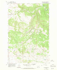
1966 · Ellis Canyon
USGS Topo · 1:24,000