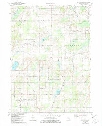
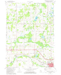
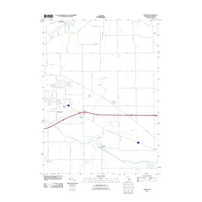
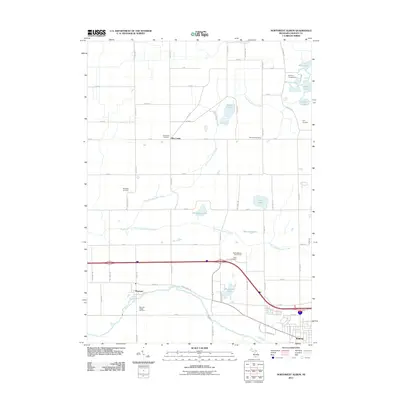
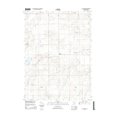
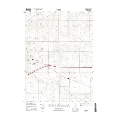
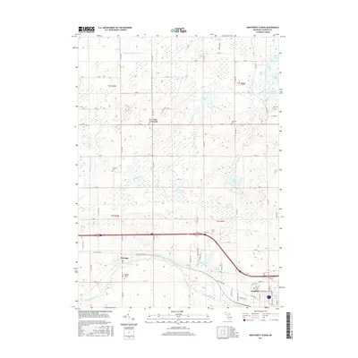
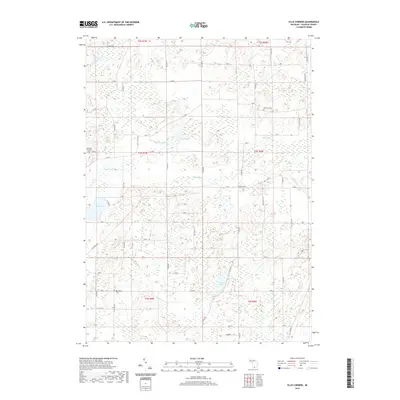
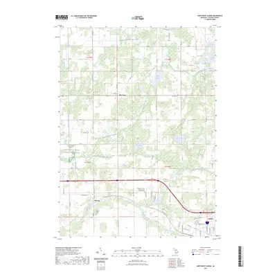
1982 Map of Ellis Corners
USGS Topo · Published 1982About this map
Ellis Corners sits at the heart of this agricultural region in southern Michigan, where the landscape is defined by a complex network of glacial lakes and slow-moving waterways. The map illustrates a rural economy reliant on several prominent streams, including Nottawa Creek, Crooked Creek, and Alder Creek, which wind through the township boundaries of Fredonia, Newton, and Burlington. The prevalence of family-named roads and rural burial grounds like Houston Cem and Barrington Cem provides a detailed look at the local genealogy and settlement patterns established by the early 1980s. Local religious life is centered around community landmarks such as Fredonia Holiness Ch and Salem Ch. The area is also notable for its recreational water bodies, with a Boat Ramp on Warner Lake and clusters of development around Lee Lake, showing how the natural drainage of the State of Michigan shaped its mid-century rural communities.
Find a feature on this map
55 named features on this map. Tap any name to fly to it.
Don’t see what you’re looking for? This feature index may not catch every label — zoom into the map to look around manually.
Map Details
Editions of this 1982 Ellis Corners Map
This is the sole edition of this map. No revisions or reprints were ever made.
Historical Maps of Tekonsha Township Through Time
38 maps found
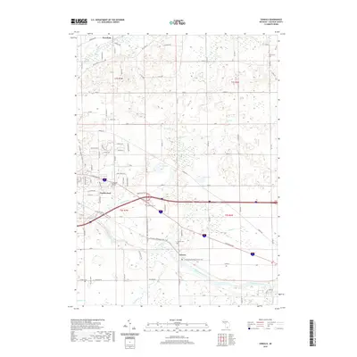
1947 Ceresco
Calhoun County, MI
1961 Ceresco
Calhoun County, MI
1980 Lyon Lake
Calhoun County, MI
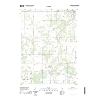
1980 Northwest Albion
Calhoun County, MI
1980 Southwest Albion
Calhoun County, MI
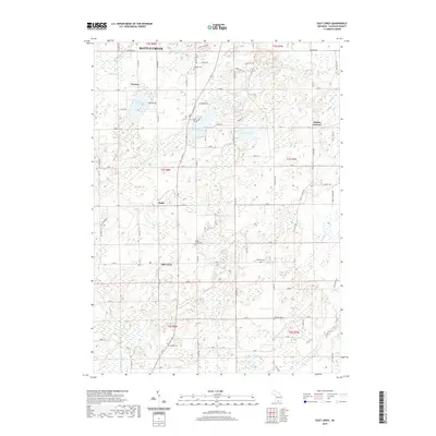
1982 East Leroy
Calhoun County, MI
1982 Ellis Corners
Calhoun County, MI
1995 Southwest Albion
Calhoun County, MI
2011 Ceresco
Calhoun County, MI
2011 East Leroy
Calhoun County, MI
2011 Ellis Corners
Calhoun County, MI
2011 Lyon Lake
Calhoun County, MI
2011 Northwest Albion
Calhoun County, MI
2011 Southwest Albion
Calhoun County, MI
2014 Ceresco
Calhoun County, MI
2014 East Leroy
Calhoun County, MI
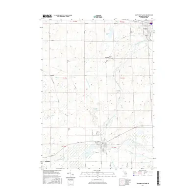
2014 Ellis Corners
Calhoun County, MI
2014 Lyon Lake
Calhoun County, MI
2014 Northwest Albion
Calhoun County, MI
2014 Southwest Albion
Calhoun County, MI
2017 Ceresco
Calhoun County, MI
2017 East Leroy
Calhoun County, MI
2017 Ellis Corners
Calhoun County, MI
2017 Lyon Lake
Calhoun County, MI
2017 Northwest Albion
Calhoun County, MI
2017 Southwest Albion
Calhoun County, MI
2019 Ceresco
Calhoun County, MI
2019 East Leroy
Calhoun County, MI
2019 Ellis Corners
Calhoun County, MI
2019 Lyon Lake
Calhoun County, MI
2019 Northwest Albion
Calhoun County, MI
2019 Southwest Albion
Calhoun County, MI
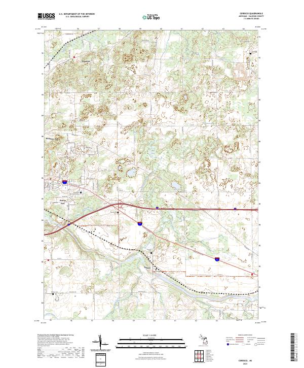
2023 Ceresco
Calhoun County, MI
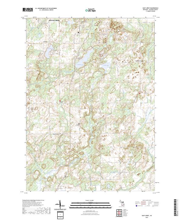
2023 East Leroy
Calhoun County, MI
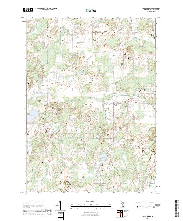
2023 Ellis Corners
Calhoun County, MI
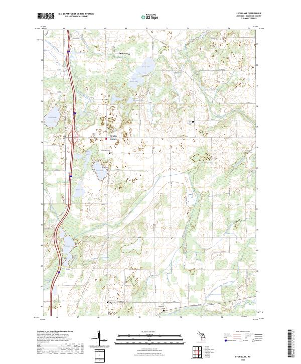
2023 Lyon Lake
Calhoun County, MI
2023 Northwest Albion
Calhoun County, MI
2023 Southwest Albion
Calhoun County, MI
Featured Locations
- Burlington Township, MI
- Emmett Charter Township, MI
- Fredonia Township, MI
- Newton Township, MI
- Tekonsha Township, MI