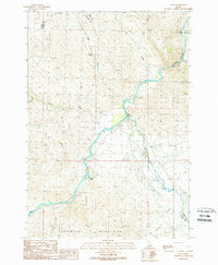
1989 Map of Ellis
USGS Topo · Published 1989About this map
The confluence of the Salmon River and the Pahsimeroi River anchors this high-desert landscape in central Idaho, where the small settlement of Ellis serves as a primary waypoint. The map details a river-centric geography where water management and conservation are evident through the Fish Hatchery and a dedicated Gaging Station Gage 4635 near the river junction. The boundary between Lemhi and Custer counties runs through the northern reaches of the quadrangle, crossing through the deep incisions of Cronks Canyon.
Find a feature on this map
20 named features on this map. Tap any name to fly to it.
Don’t see what you’re looking for? This feature index may not catch every label — zoom into the map to look around manually.
Map Details
Editions of this 1989 Ellis Map
This is the sole edition of this map. No revisions or reprints were ever made.
Other maps of this area

1955 · Dubois
USGS Topo · 1:250,000

1956 · May
USGS Topo · 1:62,500

1956 · Challis
USGS Topo · 1:62,500

1957 · Challis
USGS Topo · 1:250,000

1958 · Dubois
USGS Topo · 1:250,000

1960 · Challis
USGS Topo · 1:250,000
1962 · Allison Creek
USGS Topo · 1:24,000

1963 · Challis
USGS Topo · 1:250,000
1963 · Hat Creek
USGS Topo · 1:24,000
1963 · Wards Butte
USGS Topo · 1:24,000