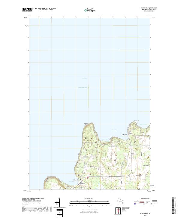
2022 Map of Ellison Bay
USGS Topo · Published 2022About this map
Ellison Bay and Gills Rock serve as the primary coastal settlements on this 2022 survey of the northern reaches of the Door Peninsula. The landscape is defined by its relationship to Lake Michigan and Green Bay, with dramatic coastal features like Deathdoor Bluff and Ellison Bluff marking the shoreline. A network of roads, including Door Bluff Park Rd and Garrett Bay Rd, provides access to the limestone bluffs and secluded harbors that characterize this region. Inland, the map documents established local sites such as the Trinity Lutheran Cem, located just south of the primary townsite. The topography transitions from the waters of Hedgehog Harbor and Wisconsin Bay to the wooded interior, where labels like Europe Lake Rd and Timberline Rd suggest a mix of residential development and preserved natural spaces.
Find a feature on this map
49 named features on this map. Tap any name to fly to it.
Don’t see what you’re looking for? This feature index may not catch every label — zoom into the map to look around manually.
Map Details
Editions of this 2022 Ellison Bay Map
This is the sole edition of this map. No revisions or reprints were ever made.
Other maps of this area

1954 · Escanaba
USGS Topo · 1:250,000

1957 · Escanaba
USGS Topo · 1:250,000

1958 · Escanaba
USGS Topo · 1:250,000

1960 · Washington Island
USGS Topo · 1:62,500

1960 · Sister Bay
USGS Topo · 1:62,500

1960 · Ellison Bay
USGS Topo · 1:62,500

1981 · Marinette
USGS Topo · 1:100,000

1982 · Washington Island NW
USGS Topo · 1:24,000
1982 · Ellison Bay
USGS Topo · 1:24,000
1982 · Washington Island SW
USGS Topo · 1:24,000