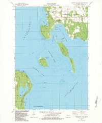
1982 Map of Washington Island SW
USGS Topo · Published 1983About this map
Detroit Harbor serves as the focal point of this coastal survey, where the protected waters of Figenschau Harbor and West Harbor meet the northern reaches of Green Bay. The landscape is defined by the hazardous maritime passages of the Door Peninsula, specifically the Porte Des Morts Passage and Detroit Island Passage, which separate the mainland at Northport from a string of islands. On Plum Island, the U S Coast Guard Station stands as a critical waypoint for vessels navigating between Lake Michigan and the bay. To the south, the preservation of the shoreline is evident in the sprawling Liberty Grove State Park and the secluded Europe Lake. The map captures the island's essential infrastructure, from the High Sch and Powerplant to the local economy represented by several Gravel Pits and a Quarry near Sand Dunes Park.
Find a feature on this map
50 named features on this map. Tap any name to fly to it.
Don’t see what you’re looking for? This feature index may not catch every label — zoom into the map to look around manually.
Map Details
Editions of this 1982 Washington Island SW Map
2 editions found
Other maps of this area

1954 · Escanaba
USGS Topo · 1:250,000

1957 · Escanaba
USGS Topo · 1:250,000

1958 · Escanaba
USGS Topo · 1:250,000

1960 · Washington Island
USGS Topo · 1:62,500

1960 · Sister Bay
USGS Topo · 1:62,500

1960 · Ellison Bay
USGS Topo · 1:62,500

1981 · Marinette
USGS Topo · 1:100,000

1982 · Washington Island SE
USGS Topo · 1:24,000

1982 · Washington Island NW
USGS Topo · 1:24,000
1982 · Ellison Bay
USGS Topo · 1:24,000