
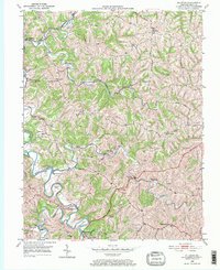
1950 Map of Elliston
USGS Topo · Published 1952About this map
Eagle Creek snakes through the southern half of this mid-century landscape, defining the rural character of Grant County. The topography is dominated by the deeply incised valleys of Tenmile Creek and Arnolds Creek, where numerous fords such as Eagle Mill Ford provided vital crossing points before modern bridge infrastructure was fully realized. Small rural centers like Elliston and Downingsville serve as focal points for the surrounding agricultural community, often established at significant road junctions or near water sources.
Find a feature on this map
39 named features on this map. Tap any name to fly to it.
Don’t see what you’re looking for? This feature index may not catch every label — zoom into the map to look around manually.
Map Details
Editions of this 1950 Elliston Map
2 editions found
Other maps of this area

1943 · Patriot
USGS Topo · 1:24,000

1950 · Mason
USGS Topo · 1:24,000

1950 · Glencoe
USGS Topo · 1:24,000

1950 · Williamstown
USGS Topo · 1:24,000

1950 · Owenton
USGS Topo · 1:24,000

1950 · Verona
USGS Topo · 1:24,000

1950 · Walton
USGS Topo · 1:24,000

1950 · Lawrenceville
USGS Topo · 1:24,000
1951 · Patriot
USGS Topo · 1:24,000

1956 · Louisville
USGS Topo · 1:250,000