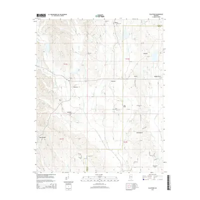
2015 Map of Ellistown
USGS Topo · Published 2015About this map
Ellistown and its surrounding rural communities are situated along the boundary between Union and Lee Counties. This 2015 edition highlights a landscape defined by its creek valleys and cemetery locations, documenting long-standing family and community sites such as Thompson Cem, Damascus Cem, and the New Hope Cem near the upper reaches of Bridge Cr. The topography reveals the intricate drainage of the region, where Saumill Cr and Camp Cr feed into a network of small streams that historically shaped local movement and settlement patterns. To the south, Birmingham and Blue Springs provide anchor points for the township, while smaller locales like Jug Fork and Branyan appear at rural intersections. These labels offer a detailed view of the North Mississippi backcountry, preserving the names of local landmarks like Bart Hill and the winding Boggan Bend along the eastern edge of the survey.
Find a feature on this map
98 named features on this map. Tap any name to fly to it.
Don’t see what you’re looking for? This feature index may not catch every label — zoom into the map to look around manually.
Map Details
Editions of this 2015 Ellistown Map
This is the sole edition of this map. No revisions or reprints were ever made.
Other maps of this area

1921 · Booneville
USGS Topo · 1:48,000

1921 · Tupelo
USGS Topo · 1:48,000

1922 · Booneville
USGS Topo · 1:62,500

1923 · Tupelo
USGS Topo · 1:62,500

1955 · Ripley
USGS Topo · 1:62,500

1955 · Sherman
USGS Topo · 1:62,500

1956 · Tupelo
USGS Topo · 1:250,000

1958 · Tupelo
USGS Topo · 1:250,000

1973 · Guntown
USGS Topo · 1:24,000
1973 · Tupelo
USGS Topo · 1:24,000