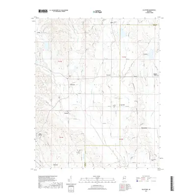
2018 Map of Ellistown
USGS Topo · Published 2018About this map
Ellistown and its surrounding countryside in northeastern Mississippi are documented here along the Union and Lee county line. This 2018 survey reveals a landscape of small agricultural settlements and hamlets, including Parks, Alpine, Corrona, and Birmingham. The topography is defined by the drainage systems of Hall Creek, Bridge Creek, and Camp Creek, which feed into the wider watershed.
Find a feature on this map
101 named features on this map. Tap any name to fly to it.
Don’t see what you’re looking for? This feature index may not catch every label — zoom into the map to look around manually.
Map Details
Editions of this 2018 Ellistown Map
This is the sole edition of this map. No revisions or reprints were ever made.
Other maps of this area

1921 · Booneville
USGS Topo · 1:48,000

1921 · Tupelo
USGS Topo · 1:48,000

1922 · Booneville
USGS Topo · 1:62,500

1923 · Tupelo
USGS Topo · 1:62,500

1955 · Ripley
USGS Topo · 1:62,500

1955 · Sherman
USGS Topo · 1:62,500

1956 · Tupelo
USGS Topo · 1:250,000

1958 · Tupelo
USGS Topo · 1:250,000

1973 · Guntown
USGS Topo · 1:24,000
1973 · Tupelo
USGS Topo · 1:24,000