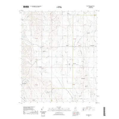
2020 Map of Ellistown
USGS Topo · Published 2020About this map
Blue Springs and the surrounding rural communities of Union Co and Lee Co are defined by a complex network of creeks and ridges that have shaped local settlement for generations. The landscape is characterized by prominent elevations such as Bart Hill and the long expanse of Birmingham Ridge, which separate the various watersheds of McWhorter Cr, Brown Cr, and Bridge Cr. This topographic arrangement has historically dictated the placement of small hamlets and farmsteads, many of which are anchored by community gathering places like Jug Fork and Fairfield.
Find a feature on this map
102 named features on this map. Tap any name to fly to it.
Don’t see what you’re looking for? This feature index may not catch every label — zoom into the map to look around manually.
Map Details
Editions of this 2020 Ellistown Map
This is the sole edition of this map. No revisions or reprints were ever made.
Other maps of this area

1921 · Booneville
USGS Topo · 1:48,000

1921 · Tupelo
USGS Topo · 1:48,000

1922 · Booneville
USGS Topo · 1:62,500

1923 · Tupelo
USGS Topo · 1:62,500

1955 · Ripley
USGS Topo · 1:62,500

1955 · Sherman
USGS Topo · 1:62,500

1956 · Tupelo
USGS Topo · 1:250,000

1958 · Tupelo
USGS Topo · 1:250,000

1973 · Guntown
USGS Topo · 1:24,000
1973 · Tupelo
USGS Topo · 1:24,000