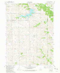
1981 Map of Ellston
USGS Topo · Published 1981About this map
Sun Valley Lake serves as a central feature in this southern Iowa landscape, surrounded by the townships of Union, Richland, and Monroe. The terrain is defined by a network of waterways, including Lotts Creek and the Grand River, which wind through the rural countryside. The infrastructure of the early 1980s is clearly visible, with an Old Railroad Grade cutting across the central portion of the sheet between Ellston and Beaconsfield.
Find a feature on this map
21 named features on this map. Tap any name to fly to it.
Don’t see what you’re looking for? This feature index may not catch every label — zoom into the map to look around manually.
Map Details
Editions of this 1981 Ellston Map
This is the sole edition of this map. No revisions or reprints were ever made.
Other maps of this area

1945 · Mount Ayr
USGS Topo · 1:62,500

1945 · Lamoni
USGS Topo · 1:62,500

1947 · Lamoni
USGS Topo · 1:62,500

1947 · Mount Ayr
USGS Topo · 1:62,500

1954 · Centerville
USGS Topo · 1:250,000

1955 · Nebraska City
USGS Topo · 1:250,000

1957 · Nebraska City
USGS Topo · 1:250,000

1957 · Centerville
USGS Topo · 1:250,000

1958 · Centerville
USGS Topo · 1:250,000

1958 · Nebraska City
USGS Topo · 1:250,000