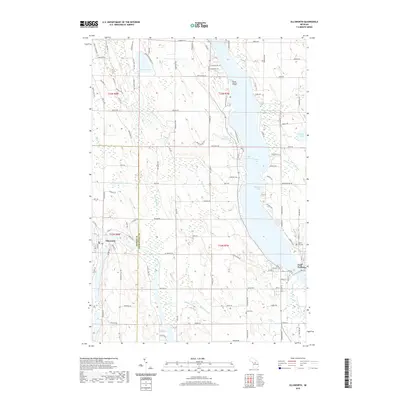
2019 Map of Ellsworth
USGS Topo · Published 2019About this map
Holy Island sits at the northern end of the Lake Charlevoix South Arm, a defining water body that separates the western rolling hills from the eastern terrain. This survey captures the transition between Antrim Co and Charlevoix Co, where the village of Ellsworth and the city of East Jordan serve as local centers. The landscape is heavily influenced by the drainage patterns of the Jordan River and Intermediate River, which flow through a network of smaller tributaries like Runney Cr and Saint Clair Cr.
Find a feature on this map
119 named features on this map. Tap any name to fly to it.
Don’t see what you’re looking for? This feature index may not catch every label — zoom into the map to look around manually.
Map Details
Editions of this 2019 Ellsworth Map
This is the sole edition of this map. No revisions or reprints were ever made.
Other maps of this area

1954 · Central Lake
USGS Topo · 1:62,500

1954 · Charlevoix
USGS Topo · 1:62,500

1955 · Cheboygan
USGS Topo · 1:250,000

1958 · Cheboygan
USGS Topo · 1:250,000

1958 · Bayshore
USGS Topo · 1:62,500

1961 · Boyne City
USGS Topo · 1:62,500

1975 · Boyne City NW
USGS Topo · 1:24,000

1975 · Boyne City NE
USGS Topo · 1:24,000
1983 · Ellsworth
USGS Topo · 1:25,000
1983 · Bay Shore
USGS Topo · 1:25,000