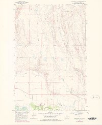
1969 Map of Ellsworth Coulee
USGS Topo · Published 1978About this map
The Milk River meanders through the southern portion of this landscape, its path shadowed by the historic Lewis and Clark Trail. This 1969 field-checked survey reveals a topography defined by drainage coulees and water management in a semi-arid ranching environment. Named features such as Ellsworth Coulee, Lund Coulee, and Long Coulee cut through the terrain, leading toward the river valley. The map documents several water sources vital to local operations, including Whitbread Springs, Confusion Reservoir, and VR-80 Reservoir.
Find a feature on this map
21 named features on this map. Tap any name to fly to it.
Don’t see what you’re looking for? This feature index may not catch every label — zoom into the map to look around manually.
Map Details
Editions of this 1969 Ellsworth Coulee Map
2 editions found
Other maps of this area

1906 · Hinsdale Special Map
USGS Topo · 1:62,500

1919 · Boundary
USGS Topo · 1:125,000

1943 · Glasgow
USGS Topo · 1:125,000

1954 · Glasgow
USGS Topo · 1:250,000

1957 · Glasgow
USGS Topo · 1:250,000

1958 · Glasgow
USGS Topo · 1:250,000
1969 · Tampico
USGS Topo · 1:24,000

1969 · Vandalia
USGS Topo · 1:24,000
1969 · Tampico NE
USGS Topo · 1:24,000

1969 · Ellsworth Coulee
USGS Topo · 1:24,000