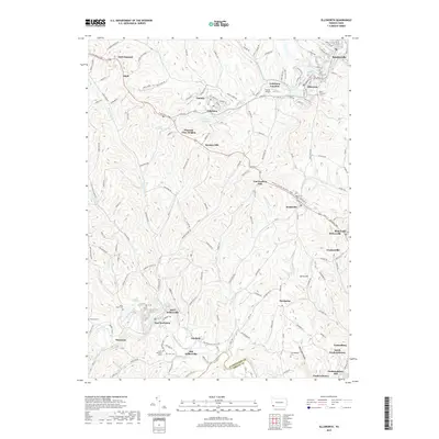
2019 Map of Ellsworth
USGS Topo · Published 2019About this map
Scenery Hill and the surrounding coal-country settlements of Bentleyville and Ellsworth define this portion of Washington County. The landscape is characterized by a dense network of small communities and crossroads such as Cokeburg, Beallsville, and Marianna, which developed along the ridges and valley floors. Waterways like Tenmile Creek and Pigeon Creek wind through the hills, punctuated by industrial and aviation markers like the Horne Airport. Local history is deeply embedded in the terrain, evidenced by numerous family and parish burial grounds including Saint Lukes Cem, Horn Cem, and Buckingham Cem. The convergence of historic routes like the E National Pike and Rte 917 reflects a long-standing transportation corridor between the Monongahela River and the interior highlands. Unique place names such as Black Dog Hollow and Van Voorhis Hill offer specific points of interest for genealogists and local researchers tracing ancestral lands.
Find a feature on this map
167 named features on this map. Tap any name to fly to it.
Don’t see what you’re looking for? This feature index may not catch every label — zoom into the map to look around manually.
Map Details
Editions of this 2019 Ellsworth Map
This is the sole edition of this map. No revisions or reprints were ever made.
Other maps of this area

1900 · Masontown
USGS Topo · 1:62,500

1901 · Amity
USGS Topo · 1:62,500

1901 · Waynesburg
USGS Topo · 1:62,500

1902 · Brownsville
USGS Topo · 1:62,500

1903 · Masontown
USGS Topo · 1:62,500

1904 · Amity
USGS Topo · 1:62,500

1904 · Waynesburg
USGS Topo · 1:62,500

1906 · Brownsville
USGS Topo · 1:62,500

1931 · Brownsville
USGS Topo · 1:62,500

1931 · Masontown
USGS Topo · 1:62,500