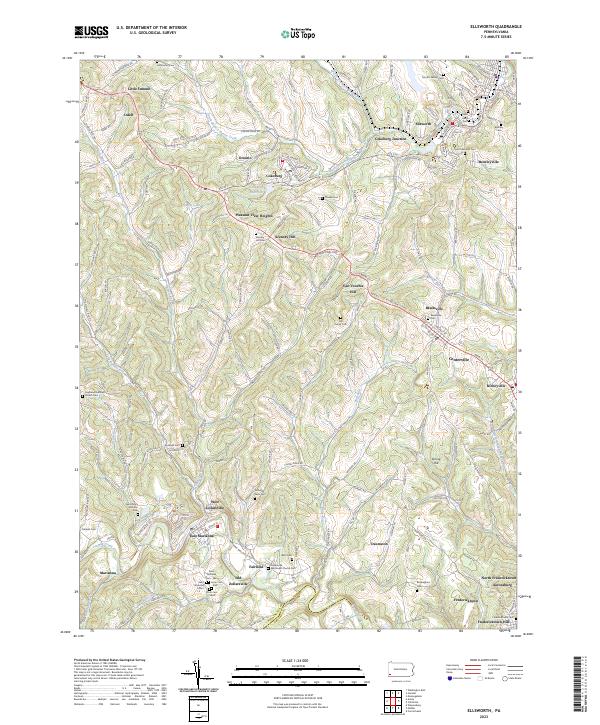
2023 Map of Ellsworth
USGS Topo · Published 2023About this map
Tenmile Creek and the South Branch Pigeon Creek carve through this corner of Washington County, defining a landscape of high ridges like Laurel Ridge and Spring Hill. The settlement pattern reflects the area's industrial and agricultural history, with towns such as Marianna, Ellsworth, and Bentleyville serving as focal points. The density of family and community burial grounds, including the Morton Family Cem and Richards Farm Cem, suggests a long-standing residential stability in the rural outskirts.
Find a feature on this map
163 named features on this map. Tap any name to fly to it.
Don’t see what you’re looking for? This feature index may not catch every label — zoom into the map to look around manually.
Map Details
Editions of this 2023 Ellsworth Map
This is the sole edition of this map. No revisions or reprints were ever made.