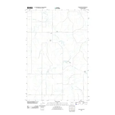
2011 Map of Elm Coulee
USGS Topo · Published 2011About this map
Mona Cemetery stands as a quiet focal point in this portion of Richland County, surrounded by a landscape defined by its seasonal drainage patterns and ranching infrastructure. The geography is marked by the winding courses of East Charlie Creek, Middle Charlie Creek, and Shack Creek, which carve through the high plains. The reliance on water management in this arid region is evident through several small reservoirs and containment structures, including Elm Dam, Bidegary Dam, and Peer Number 1 Dam.
Find a feature on this map
17 named features on this map. Tap any name to fly to it.
Don’t see what you’re looking for? This feature index may not catch every label — zoom into the map to look around manually.
Map Details
Editions of this 2011 Elm Coulee Map
This is the sole edition of this map. No revisions or reprints were ever made.
Other maps of this area

1909 · Glendive
USGS Topo · 1:250,000

1914 · Brockton
USGS Topo · 1:62,500

1954 · Glendive
USGS Topo · 1:250,000

1954 · Wolf Point
USGS Topo · 1:250,000

1957 · Glendive
USGS Topo · 1:250,000

1958 · Wolf Point
USGS Topo · 1:250,000

1958 · Glendive
USGS Topo · 1:250,000
1969 · Twomile Creek
USGS Topo · 1:24,000

1969 · Dugout Creek
USGS Topo · 1:24,000
1972 · Frog Coulee
USGS Topo · 1:24,000