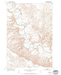
1953 Map of Elm Creek
USGS Topo · Published 1994About this map
The Belle Fourche River dominates this mid-century landscape in Meade County, winding in sharp, dramatic oxbows through the rural terrain of South Dakota. In the early 1950s, this area remained sparsely populated, characterized by isolated educational outposts and rugged cattle-country geography. Local history and genealogy researchers can pinpoint the exact locations of the rural Bachand Sch and Hayes Sch, which served as the community hubs for ranching families scattered across the plains. The terrain is further defined by the Alkali region and the drainage of Elm Creek, which feeds into the larger river system. This survey preserves the exact placement of local roads and property boundaries as they existed before modern land-use changes, providing a clear record of a traditional Western ranching environment.
Find a feature on this map
5 named features on this map. Tap any name to fly to it.
Don’t see what you’re looking for? This feature index may not catch every label — zoom into the map to look around manually.
Map Details
Editions of this 1953 Elm Creek Map
2 editions found

Other maps of this area

1893 · Rapid
USGS Topo · 1:125,000

1898 · Rapid
USGS Topo · 1:125,000

1903 · Rapid
USGS Topo · 1:125,000

1913 · Newell
USGS Topo · 1:125,000

1951 · Volunteer
USGS Topo · 1:24,000

1951 · Volunteer SE
USGS Topo · 1:24,000

1953 · Rapid City 1 SW
USGS Topo · 1:24,000

1953 · Rapid City 1 NW
USGS Topo · 1:24,000

1953 · Hereford
USGS Topo · 1:24,000

1953 · Hereford SW
USGS Topo · 1:24,000