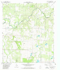
1979 Map of Elm Grove
USGS Topo · Published 1980About this map
The Colorado River winds through the heart of this Central Texas landscape at the meeting point of Brown, McCulloch, and San Saba counties. This late-1970s survey captures a rural ranching and farming community centered around Elm Grove, where the Elm Grove Ch and a nearby Community Center and Rodeo Ground served as local focal points. To the west, the small settlement of Milburn sits near the riverbanks, while the terrain is defined by prominent elevations such as Buzzard Mountain and Brushy Mountain. Genealogists will find particular value in the clearly marked Beasley Cemetery and Mc Carty Cemetery, as well as the location of Holt Ch in the southern portion of the quadrangle. The map also documents the drainage patterns of numerous local waterways, including Deep Creek, Antelope Creek, and Rough Creek, which carve through the limestone-rich hills of the Edwards Plateau region.
Find a feature on this map
27 named features on this map. Tap any name to fly to it.
Don’t see what you’re looking for? This feature index may not catch every label — zoom into the map to look around manually.
Map Details
Editions of this 1979 Elm Grove Map
This is the sole edition of this map. No revisions or reprints were ever made.
Other maps of this area

1885 · San Saba
USGS Topo · 1:125,000

1887 · Coleman
USGS Topo · 1:125,000

1889 · Brownwood
USGS Topo · 1:125,000

1889 · Coleman
USGS Topo · 1:125,000

1894 · Brady
USGS Topo · 1:125,000

1894 · Brownwood
USGS Topo · 1:125,000

1894 · San Saba
USGS Topo · 1:125,000

1925 · Brady 1-b
USGS Topo · 1:48,000

1925 · Brady 1-a
USGS Topo · 1:48,000

1925 · San Saba 2-b
USGS Topo · 1:48,000