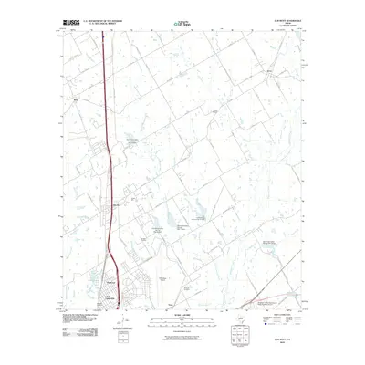
2010 Map of Elm Mott
USGS Topo · Published 2010About this map
Lacy-Lakeview and Northcrest anchor the southern edge of this McLennan County landscape, where suburban expansion meets the agricultural drainages of the Texas Blackland Prairies. The corridor is defined by the New Dallas Hwy, which passes through the community of Elm Mott, a historic rail and road stop. For genealogists, several local burial sites are documented across the rural landscape, including Gerald Cemetery near Elm Creek and Concord Cemetery tucked along the Kirkland Branch.
Find a feature on this map
80 named features on this map. Tap any name to fly to it.
Don’t see what you’re looking for? This feature index may not catch every label — zoom into the map to look around manually.
Map Details
Editions of this 2010 Elm Mott Map
This is the sole edition of this map. No revisions or reprints were ever made.
Other maps of this area

1892 · Waco
USGS Topo · 1:125,000

1920 · Waco
USGS Topo · 1:125,000

1920 · Mart
USGS Topo · 1:62,500

1924 · Waco 4-c
USGS Topo · 1:48,000

1931 · Elm Mott
USGS Topo · 1:62,500

1954 · Waco
USGS Topo · 1:250,000

1955 · Waco
USGS Topo · 1:250,000

1956 · Penelope
USGS Topo · 1:24,000

1956 · Axtell
USGS Topo · 1:24,000

1956 · West
USGS Topo · 1:24,000