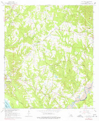
1965 Map of Elm Park
USGS Topo · Published 1977About this map
Rosedown Plantation and Cottage Plantation anchor the landscape of West Feliciana Parish in the mid-1960s, reflecting the deep-rooted agricultural history of the region. This survey captures a rural landscape where family and community heritage is preserved in numerous burial grounds, such as Locust Grove Cem and Sage Hill Cem. The area is defined by its relationship with water and rail, with the Mississippi River and Thompson Creek forming significant boundaries, while the Illinois Central Railroad cuts through the western terrain near Beachwood. Educational and religious life are represented by the Rosenwald Sch and numerous country churches like Mt Pilgrim Ch and Raspberry Ch. The presence of the Audubon Memorial State Park marks a dedicated effort to preserve the local natural and historic legacy amidst the working farms and Gravel Pit operations of the era.
Find a feature on this map
49 named features on this map. Tap any name to fly to it.
Don’t see what you’re looking for? This feature index may not catch every label — zoom into the map to look around manually.
Map Details
Editions of this 1965 Elm Park Map
3 editions found
Other maps of this area

1906 · Bayou Sara
USGS Topo · 1:125,000

1939 · St. Francisville
USGS Topo · 1:62,500

1939 · Zachary
USGS Topo · 1:62,500

1941 · Lost Creek
USGS Topo · 1:31,680

1945 · Jackson
USGS Topo · 1:31,680

1945 · Lost Creek
USGS Topo · 1:31,680

1953 · New Roads
USGS Topo · 1:24,000

1954 · Zachary
USGS Topo · 1:24,000

1954 · Port Hudson
USGS Topo · 1:24,000

1954 · Elm Park
USGS Topo · 1:24,000